Texas Tribune
One in five Texans lives in a floodplain, state’s first-ever analysis shows
One in five Texans lives in a floodplain, state's first-ever analysis shows
“One in five Texans lives in a floodplain, state's first-ever analysis shows” was first published by The Texas Tribune, a nonprofit, nonpartisan media organization that informs Texans — and engages with them — about public policy, politics, government and statewide issues.
Sign up for The Brief, The Texas Tribune's daily newsletter that keeps readers up to speed on the most essential Texas news.
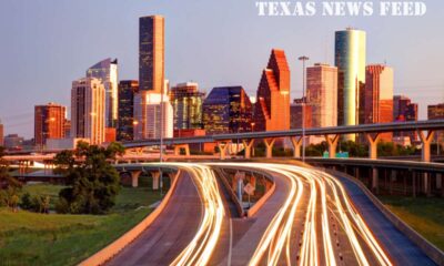
Almost 6 million Texans, or about 20% of the population, live in an area susceptible to flooding and one-fifth of the state's land is in a 100-year floodplain, according to first-of-its-kind data gathered as part of a statewide effort to harden Texas against floods and rising sea levels.
The analysis is part of the Texas Water Development Board's first statewide flood plan, still in development, which the Legislature required in a 2019 law passed in response to Hurricane Harvey. Flood risks in Texas are increasing as climate change brings heavier precipitation, stronger hurricanes and sea level rise and as the state's population continues to climb.
More than 2.4 million Texans live in areas that have a 1% chance of flooding each year, known as the 100-year floodplain, the analysis found. Another 3.5 million people live in areas with a 0.2% chance of flooding each year, known as the 500-year floodplain.
Roughly 56,000 square miles of Texas now fall within the 100-year floodplain, TWDB staff said in a presentation this week.
It will likely cost Texas tens of billions of dollars to protect people and property from floods. The first projects proposed in the plan add up to $38 billion, including the massive coastal barrier proposal with its “Ike Dike,” a huge gate system proposed for the mouth of Galveston Bay.
“Getting this program up and running is a really big deal,” TWDB Chair Brooke Paup said before the board approved the 15 regional plans, a major step in creating the statewide flood plan. Each region is built around one of the state's major watersheds.
“I know it'll truly go so far to save lives and people's homes,” Paup said.
As climate change worsens, higher global temperatures increase the amount of moisture in the air and thus the risk of extreme rainfall events, the Texas state climatologist and a national climate assessment have found. Heavier precipitation linked to climate change likely increased Hurricane Harvey's total rainfall by as much as 19%, one study found. Almost 50 inches of rain fell in some areas of Houston during Harvey — the highest rainfall amount in a single storm for any place in the continental U.S.
At the same time, higher global temperatures are melting glaciers, increasing sea levels around the world — including in Texas — and making coastlines more vulnerable to storm surges. Between 2000 and 2019, rising sea levels caused the Texas coastline to retreat about 4 feet per year on average, according to a 2021 University of Texas Bureau of Economic Geology report for the Texas General Land Office.
Reem Zoun, director of flood planning at the TWDB, said that to decide how to prevent flooding in Texas, the agency first needed to identify which areas of the state were at the most risk. The analysis identified how many buildings, homes, people, hospitals, roads and agricultural areas are in a floodplain.
The San Jacinto region, which includes Harris County and Galveston, has the most people living in a floodplain: almost 2.5 million people are in a 100- or 500-year floodplain. The Lower Rio Grande region, which spans much of Texas' southern border and includes the Rio Grande Valley, is next with about 1 million people at risk.
Though floodplains are defined by the Federal Emergency Management Agency, the agency does not map every inch of the U.S. and its maps have long been criticized as out of date and underestimating actual flood risk.
Texas used existing flood data to create the maps that served as a baseline that regions could add to with their own flood hazard maps — if any existed — and supplement with knowledge from local water managers. In regions with very little data, gaps were filled with data from a contracted flood risk modeling data company called Fathom.
Sixty-three of Texas' 254 counties had no existing flood hazard information prior to the planning effort, according to the TWDB.
In the Canadian-Upper Red region, for example, which includes much of the Panhandle and Wichita Falls, hardly any flood maps existed, while 98% of the Lower Red-Sulphur-Cypress region in the northeast corner of the state had inadequate flood mapping, James Bronikowski, TWDB's manager for regional flood planning told the board on Tuesday.
The TWDB often functions as a water infrastructure bank and intends to use the planning process to help finance the construction of flood prevention projects with low-cost loans and grants, although the cost of the projects far outweighs the money that's been dedicated to the agency by lawmakers.
During the 2023 legislative session, lawmakers allocated $625 million to finance flood prevention projects through the Flood Infrastructure Fund. Once the statewide flood plan is finalized, projects will have to be included in the plan in order to access those funds.
Another $550 million of the surplus was allocated to the coastal barrier project that includes the Ike Dike.
Disclosure: The Texas General Land Office has been a financial supporter of The Texas Tribune, a nonprofit, nonpartisan news organization that is funded in part by donations from members, foundations and corporate sponsors. Financial supporters play no role in the Tribune's journalism. Find a complete list of them here.
Join us for conversations that matter with newly announced speakers at the 2023 Texas Tribune Festival, in downtown Austin from Sept. 21-23.
This article originally appeared in The Texas Tribune at https://www.texastribune.org/2023/07/28/texas-floodplain-water-development-board-flood-plan/.
The Texas Tribune is a member-supported, nonpartisan newsroom informing and engaging Texans on state politics and policy. Learn more at texastribune.org.
Did you miss our previous article…
https://www.galvestontrendingnews.com/?p=7930


by By Emily Foxhall, The Texas Tribune – 2024-05-20 05:00:00
SUMMARY: Recent floods in Harris County, Texas, have devastated homes along the San Jacinto River. Tom Madigan, who owns multiple properties, quickly started repairs without knowing the Harris County Flood Control District aims to buy out such flood-prone properties. The region has a longstanding buyout program to remove homes from high-risk flood areas, with about 800 out of 2,400 targeted properties purchased. However, buyouts are voluntary and often insufficient for low-income residents. Despite the program, many choose to stay due to affordability and community ties, while others like Madigan remain skeptical of receiving a fair offer.
—————-
FULL ARTICLE:
Sign up for The Brief, The Texas Tribune's daily newsletter that keeps readers up to speed on the most essential Texas news.
HARRIS COUNTY — After the floodwaters earlier this month just about swallowed two of the six homes that 60-year-old Tom Madigan owns on the San Jacinto River, he didn't think twice about whether to fix them. He hired people to help, and they got to work stripping the walls, pulling up flooring and throwing out water-logged furniture.
What Madigan didn't know: The Harris County Flood Control District wants to buy his properties as part of an effort to get people out of dangerously flood-prone areas.
Back-to-back storms drenched southeast Texas in late April and early May, causing flash flooding and pushing rivers out of their banks and into low-lying neighborhoods. Officials across the region urged people in vulnerable areas to evacuate.
Like Madigan's, some places that were inundated along the San Jacinto in Harris County have flooded repeatedly. And for nearly 30 years, the flood control district has been trying to clear out homes around the river by paying property owners to move, then returning the lots to nature.
The recent floods show why buyout programs can be important. These spots typically flood first and worse. Gov. Greg Abbott reported that hundreds of rescues took place in the state while the floods destroyed homes. A man drowned and a child was swept away into the floods. One Harris County resident described climbing on top of his motor home as the water rose before first responders rescued him.
But the disaster and its aftermath also illustrate why buyouts are complicated to carry out even in Harris County, home to Houston, which has one of the most robust buyout programs in the country. The flood control district has identified roughly 2,400 properties as current buyout candidates around the San Jacinto; the district and county have bought about 800 of them.
Nearly all of the district's buyouts are voluntary. If an owner doesn't want to sell, the district can't force them out.
Buyouts make sense for some people who can't be protected from floods, said Alessandra Jerolleman, director of research for the Center on Environment, Land and Law at Loyola University New Orleans College of Law.
But buyouts might not provide lower-income people enough money to get somewhere safer, she said, and they could lose important support like child care from nearby family or neighbors.
“It's not as though it's a guarantee of reducing risks to that family,” Jerolleman said.

Top left: William Clark sands wood that flooded at a rental property owned by Tom Madigan in River Terrace in Harris County on May 14, 2024. Top right: Discarded wood piles up outside a home damaged by flooding in the Northshore neighborhood of Houston in Kingwood. Bottom: Madigan shows the line where flood water reached at a property he owns.
Credit:
Danielle Villasana for The Texas Tribune
People who live near the river and who have endured repeated floods explained that they've stayed because it's affordable and, most of the time, peaceful. Where else would they be able to buy anything like it? Some said they didn't think the government would offer them what they consider a fair price to sell their land. Some didn't know the buyout program existed.
Madigan started buying homes more than 15 years ago in the unincorporated River Terrace neighborhood because they were cheap. On Tuesday, the Houston firefighter drank a Heineken and grilled hamburgers for his work crew outside his most damaged house, which he rents to his brother. Sodden rugs baked in the sun on the driveway.
Madigan said he might have taken a buyout if it was a reasonable offer — but he doubted it would be. He said he needed to get the properties ready again for his renters. “I can't wait,” he said.
Two blocks away, water had swept through a yellow house Madigan rents to a family with a teenage son. One of the workers fixing the property, 21-year-old Omar Reyna, watched the family throw out pretty much everything they had. Piecing together new laminate flooring with his dad, Reyna kept thinking about a trash bag of Teddy bears and stuffed toys he tossed out for them.
He wondered if the parents had been saving the toys for another kid they might have in the future.
“The faster we get it done, the faster they can come back in here,” Reyna said.
Some people choose to live with the risk of flooding
The San Jacinto is the largest river in the state's most populous county. For years before Harris County's first floodplain maps were drawn up in the mid-1980s, people built homes near its banks. Even today, people can still build in the vast floodplain if the houses are high enough and have enough stormwater detention.
The flood control district tries to buy out homes in pockets of the floodplain that are deepest, said James Wade, manager for the district's property acquisition department. Those are places where engineers can't easily fix flooding problems.
Buyouts are meant to get people out of flood zones before their property floods again, not to help in the immediate aftermath of a disaster. The process is slow: In some cases, it can take 18 months or longer to approve a buyout application, Wade said. The district pays owners the market value or pre-flood value for their house, determined by a third-party appraiser, plus moving expenses and a supplement to help them get into a house out of the floodplain, Wade said.
/https://static.texastribune.org/media/files/e425edcd569f3e5dfe59f8a1a000ad14/0514%20Flood%20Buyouts%20DV%20TT%2019.jpg)
The aftermath of the flooding on a street outside Houston near the Trinity River.
Credit:
Danielle Villasana for The Texas Tribune
“It's a very equitable, fair program,” Wade said — but still some people don't want to leave.
Those who stay learn to adapt. They build homes on stilts. They monitor the river level and watch for releases of water from the Lake Conroe dam upstream. Some know intimately the routine of rebuilding: gut the house, clean it, put it back together.
The floor of 49-year-old Sean Vincent's house in the Forest Cove neighborhood in northeast Houston is 15 feet above the ground. Three feet of water flooded it when Hurricane Harvey hit in 2017. This month, the floods reached five feet high on Vincent's property. He cleaned out his waterlogged ground-level shed with help from church members. On Tuesday, he was building new shelves for it.
But most of the time Vincent, who works in railroad traffic control, said he enjoys the space surrounded by tall trees with room for his three kids.
“It's just really not a major part of our life,” Vincent said of the flooding. “Yes, it's inconvenient. Yes, it's now happened to us twice in seven years … It's sort of a trade-off for us. And it is lovely out here.”
“Where are you going to go?”
Then there are those who stay because they don't see anywhere else to go.
Jack St. John, 67, a retired long-haul truck driver, moved to Northshore 43 years ago and has had to clean up after two floods. He worries any time flooding threatens, but the neighborhood's advantages keep him there: He has no water bill because he has a well. His taxes are reasonable. The neighborhood has a fish fry in the spring and a barbecue in the fall.
“You know, when you leave, where are you going to go?” he said. “What's it going to cost to buy into another place?”
Farther northeast, in the Idle Wild and Idle Glen neighborhoods, the floods forced some residents to sleep under tarps. On one largely forested street, boats were turned sideways or flipped upside down. A small building was lodged in the trees. A car was in the ditch.
For several years, Elvia Bethea, 68, has driven from her home in Humble to check on people and pets here, and pick up stray animals. On Tuesday, she and other volunteers gave John Gray, 50, bamboo yard torches to fight the many mosquitoes, plus two trays of chocolate-covered strawberries.
Gray said he couldn't afford to fix up his destroyed house. He earns a living printing labor law posters for businesses. His printers at home were destroyed.
Gray said he had never heard of the buyout program but would consider taking one.
“Who do I call?” Gray asked. “I don't have a clue.”
From the back of a white SUV, Bethea handed some hot dogs to Jose Tabores, 68, who lives on Gray's land in a trailer now filled with mud.
“I'm coming for dinner, remember!” Bethea teased him.

Top left: Jason Hodges pressure washes an air conditioning unit swamped by flooding at a rental property owned by Madigan. Top right: Rodger Pace's back tattoo reads, “God Giveth and… God Taketh Away.” Bottom: Elvia Bethea, center left, passes out donated goods to John Smith III, left, John Gray, center right, and Jose Tabores, right, who were all affected by flooding.
Credit:
Danielle Villasana for The Texas Tribune
Nearby, 51-year-old Veronika Scheid had been sleeping in a wet tent. The flood washed the shipping crate she lived in down the road and into the trees — along with her and her neighbors' belongings.
At a low point, when Scheid was crying over all she lost, she found a pink-and-white beaded necklace with stitching in the shape of a “V,” like her name. At the end was a charm shaped like a house.
She was grateful the person who owned the land where she stayed hadn't taken a buyout. Otherwise she would have nowhere to go.
“At least we have this,” Scheid said.
We've got big things in store for you at The Texas Tribune Festival, happening Sept. 5–7 in downtown Austin. Join us for three days of big, bold conversations about politics, public policy and the day's news.
The post These Texans aren't taking buyouts despite repeated floods appeared first on TexasTribune.org.
The Texas Tribune is a nonprofit, nonpartisan media organization that informs Texans — and engages with them — about public policy, politics, government and statewide issues.
by By Annie Xia, The Texas Tribune – 2024-05-18 19:24:41
SUMMARY:
—————-
FULL ARTICLE:
Sign up for The Brief, The Texas Tribune's daily newsletter that keeps readers up to speed on the most essential Texas news.
DALLAS— At the National Rifle Association's annual convention on Saturday, Donald Trump and Gov. Greg Abbott encouraged the thousands gathered to vote for Trump in the 2024 presidential election as a way to ensure their Second Amendment rights.
“The NRA has stood with me from the very beginning, and with your vote, I will stand strong for your rights and liberties,” Trump said. “I heard it a few weeks ago that if gun owners voted, we would swamp them at levels that nobody's ever seen before. I think you're a rebellious bunch, but let's be rebellious and vote this time.”
Trump and Abbott spoke to a room packed with NRA members, some of which sported supportive attire from the standard-fare red caps to a dress covered with photos of the former president.
During the convention, the NRA released its endorsement for the 45th president, and the Trump political campaign announced the launch for the “Gun Owners for Trump” coalition.
Abbott touted his track record on gun rights by pointing to Texas laws passed last year, such as House Bill 3137 which prohibits local governments from requiring firearm owners to buy liability insurance. To energetic applause, he said the law ensured people would not be forced to pay to exercise their Second Amendment rights.
Abbott also described the state's successful crackdown on the recent pro-Palestinian protests on university campuses, in which protesters are demanding the schools divest from from companies tied to Israel or weapons manufacturing amid the Israel-Hamas War.
/https://static.texastribune.org/media/files/e9bd2a7031c3e610218a23c04f393ee2/0518%20NRA%20Convention%20AS%20TT%2004.jpg)
Gov. Greg Abbott speaks at the NRA Leadership Forum in Dallas on Saturday.
Credit:
Azul Sordo for the Texas Tribune
“When they tried to pull that stunt in Texas, our Department of Public Safety cleared the area, arrested the protesters and put them in jail,” Abbott said. “Unlike some of these radical leftist universities like Columbia, UCLA and far too many others, in Texas we don't tolerate paid protesters who tried to hijack our college campuses.”
Almost to the day, the NRA convention takes place two years after the Uvalde school shooting, where an 18-year-old gunned down an elementary school with a legally purchased assault rifle. The shooter killed 19 fourth-graders and two teachers with an AR-15 style rifle.
During the 2023 legislative session, Uvalde families unsuccessfully pressed Texas policymakers to pass a raise-the-age law, which would have upped the minimum age for buying semi-automatic weapons from 18 to 21.
“Donald Trump and Texas Republicans made the gun violence epidemic worse, especially in our state, where we have seen nine mass shootings just in the last 15 years,” said a statement by Gilberto Hinojosa, the Texas Democratic Party Chair, on Friday. “Even after Uvalde parents pleaded with Greg Abbott and Ted Cruz for commonsense gun safety laws, they decided, like Trump “ that the NRA and gun lobby was more important.”
Instead the legislature approved a school safety bill that established preventative measures toward school shootings. The law included a mandate that every school must hire an armed security officer and the creation of a department within the Texas Education Agency that can compel districts to adhere to active-shooter protocols.
During his speech, Trump endorsed four Republican candidates who are fighting in late May runoffs to be their party's nominee: Alan Schoolcraft, David Covey, Helen Kerwin and Brett Hagenbuch. Each of them has already received endorsements by Abbott, Attorney General Ken Paxton or both. Schoolcraft, Covey and Kerwin are running against Republican incumbents in the Texas House who impeded Abbott's signature school voucher bill or voted for Paxton's impeachment based on accusations of corruption.
We've got big things in store for you at The Texas Tribune Festival, happening Sept. 5–7 in downtown Austin. Join us for three days of big, bold conversations about politics, public policy and the day's news.
The post Trump, Abbott speak at Dallas NRA convention appeared first on TexasTribune.org.
The Texas Tribune is a nonprofit, nonpartisan media organization that informs Texans — and engages with them — about public policy, politics, government and statewide issues.
by By Marie D. De Jesús and Antranik Tavitian, Houston Landing, The Texas Tribune – 2024-05-17 14:45:42
SUMMARY: Severe storms hit the Houston area on Thursday evening, resulting in widespread damage, four fatalities, and power outages affecting nearly 900,000 homes and businesses. The Houston Office of Emergency Management is beginning recovery efforts, while officials discourage unnecessary travel. Reports from Houston Landing detail the extent of the destruction, which includes knocked-down power lines and damaged buildings, such as the Wells Fargo Plaza and the CenterPoint Energy Plaza. Photos provided by Antranik Tavitian and Marie D. De Jesús illustrate the damage seen across the region.
—————-
FULL ARTICLE:
Sign up for The Brief, The Texas Tribune's daily newsletter that keeps readers up to speed on the most essential Texas news.
Severe storms tore through the Houston area Thursday evening, causing widespread damage, killing at least four people and leaving hundreds of thousands of homes and businesses without power.
Gale force winds up to 100 mph knocked over power lines, blew out windows and toppled trees throughout the region. Houston Office of Emergency Management spokesperson Brent Taylor said officials will begin the recovery process once debris and damage are cleared. In the meantime, Houston Mayor John Whitmire and Harris County Judge Lina Hidalgo urged residents to avoid all unnecessary travel.
The storm ravaged Harris County — from transmission towers crushed in suburban Cypress to stricken oak trees blockading traffic to high-rise windows shattered throughout downtown Houston.
Here's a look at some of the damage wrought, reported by Houston Landing:
/https://static.texastribune.org/media/files/2105088efaf4454abbfd4b2fe4fb349e/0517%20Houston%20Storm%20Damage%20AT%20TT%20004.JPG)
The Muncy family looks at damaged buildings in downtown after a storm broke windows in many of the skyscrapers on Louisiana Street on May 16, 2024 in Houston.
Credit:
Antranik Tavitian/Houston Landing
/https://static.texastribune.org/media/files/2b40836fb83ba7f6a15eb59833864a79/0517%20Houston%20Storm%20Damage%20AT%20TT%20002.JPG)
A car roof is flattened after bricks from a partially collapsed wall of Conejo Malo fell on it in downtown Houston on May 16, 2024.
Credit:
Antranik Tavitian/Houston Landing
/https://static.texastribune.org/media/files/dae5a51caf4b58b9122882adea30ea5c/0517%20Houston%20Storm%20Damage%20AT%20TT%20005.JPG)
The damaged Well Fargo Plaza building in downtown Houston on May 17, 2024.
Credit:
Antranik Tavitian/Houston Landing
/https://static.texastribune.org/media/files/127acadcb3b0e06facd0f34fdf784a8c/0517%20Houston%20Storm%20Damage%20AT%20TT%20007.JPG)
A worker clears damaged windows in the CenterPoint Energy Plaza building in downtown Houston on May 17, 2024.
Credit:
Antranik Tavitian/Houston Landing
/https://static.texastribune.org/media/files/209b16b4d37c0bd0979eece8924936ab/0517%20Houston%20Storm%20Damage%20AT%20TT%20003.JPG)
Debris after the storm on Louisiana Street in downtown Houston on May 17, 2024.
Credit:
Antranik Tavitian/Houston Landing
/https://static.texastribune.org/media/files/041008174c9cb35dc94186f1f7f2f7e9/0517%20Houston%20Storm%20Damage%20AT%20TT%20006.JPG)
From left, Luke, Ryan, Jaqueline and Tanner Muncy look at the damage and debris on Louisiana Street the morning after a storm in downtown Houston on May 16, 2024.
Credit:
Antranik Tavitian/Houston Landing
/https://static.texastribune.org/media/files/afc7a925e7e0ae61da3e80d8d4720e3d/20240517_STORM_MDJ_980.jpg)
Storms damaged several transmission power lines Thursday evening near Highway 99 on May 16, 2024 in Cypress.
Credit:
Marie D. De Jesús/Houston Landing
/https://static.texastribune.org/media/files/9be64e4c6eb66848cad552d35574e366/20240516_STORM_MDJ_06.JPG)
A man stands by a fallen branch blocking TC Jester Boulevard after a storm on May 16, 2024 in Houston.
Credit:
Marie D. De Jesús/Houston Landing
/https://static.texastribune.org/media/files/6871db85bb4451acd410ff30b8c22264/20240517_STORM_MDJ_542.jpg)
Storms damaged several transmission power lines Thursday evening near Highway 99 on May 16, 2024, in Cypress.
Credit:
Marie D. De Jesús/Houston Landing
/https://static.texastribune.org/media/files/7f0a8da38c13cdb9a696282cb5ac587c/20240516_STORM_MDJ_13.JPG)
Severe thunderstorms brought in wind gusts up to 80 mph, damaging homes in Cypress on May 16, 2024.
Credit:
Marie D. De Jesús/Houston Landing
/https://static.texastribune.org/media/files/60022eb593e7521561f1b195737bd6a1/20240517_STORM_MDJ_1147.jpg)
Street signs are blown down on the corner of Bridge Creek Terrace Drive and Westgreen Boulevard on May 17, 2024 in Cypress.
Credit:
Marie D. De Jesús/Houston Landing
/https://static.texastribune.org/media/files/19bb375f0ba5b638c6c3dc3f84bbf446/20240516_STORM_MDJ_02.JPG)
Anastasia Gill, 38, takes a call in the darkness of her backyard after losing electricity on May 16, 2024 in Houston. The roof of her house sustained damages after a tree fell on it during the storm on Thursday.
Credit:
Marie D. De Jesús/Houston Landing
We've got big things in store for you at The Texas Tribune Festival, happening Sept. 5–7 in downtown Austin. Join us for three days of big, bold conversations about politics, public policy and the day's news.
The post Photos: Texas storms cause widespread damage in Houston area appeared first on TexasTribune.org.
The Texas Tribune is a nonprofit, nonpartisan media organization that informs Texans — and engages with them — about public policy, politics, government and statewide issues.

Travis County Sheriff’s Office investigating overnight homicide in northwest Austin

Who owns Red Lobster restaurants? What’s next for the largest seafood restaurant chain in the world after filing for bankrutcy

Fort Worth officer hurt in shootout with supsect

These City of Austin departments spend the most on employee salaries

How Houston ISD is faring amid school closures due to devastating storm

Iranian President Ebrahim Raisi, foreign minister and others found dead at helicopter crash site, state media says

These Texans aren’t taking buyouts despite repeated floods

Baltimore bridge collapse: Dali ship that caused deadly Francis Scott Key Bridge collapse refloated and moved

‘Portal’ installation linking Dublin and New York reopens – NBC 5 Dallas-Fort Worth

‘American Idol’ finale: Did Jack Blocker, Abi Carter or Will Moseley win?

Barge Hits Texas Bridge Causing Oil Spill: Everything We Know

Galveston bridge closure: Gulf Intracoastal Waterway closed after barge slammed into Pelican Island bridge, causing oil spill

Hundreds visit South Texas town for annual vegan festival

Cypress tornado damage: Residents in Towne Lake neighborhood react to overnight tornado damage to community

Texas restaurant named one of the most beautiful in the US, according to OpenTable

Daniel Perry case: Gov. Greg Abbott pardons former US Army sergeant convicted of killing veteran Garrett Foster at BLM protest
METRO PD Lt. Tarlesha James charged in incident involving church pastor, her attorney responds
The Mirage casino in Las Vegas is closing – NBC 5 Dallas-Fort Worth

Austin awarded $75K grant for artist to aid in highway coverings program
Houston Police chief resigns, mayor ‘shocked’ by latest investigation’s revelation | Texas
Fort Worth officer hurt in shootout with supsect
How Houston ISD is faring amid school closures due to devastating storm

Universal Basic Income goes to Texas Supreme Court

Local animal shelters in need of help following devastating derecho

‘It is outrageous:’ Senior living facility abandoned by management following storm, Mayor says

Should Texas have a guaranteed universal income plan? | FOX 7 Austin

Texas Attorney General Ken Paxton challenges guaranteed monthly income plan | FOX 7 Austin

Family opens up pool for those without power

Israeli airstrike kills 27 people, mostly women and children, in Gaza | FOX 7 Austin

Pro-Palestine protestors hold demonstration, continue calls for ceasefire in Gaza | FOX 7 Austin
-

 Local News5 days ago
Barge Hits Texas Bridge Causing Oil Spill: Everything We Know
-
Texas News5 days ago
Galveston bridge closure: Gulf Intracoastal Waterway closed after barge slammed into Pelican Island bridge, causing oil spill
-
Texas Tribune4 days ago
Hundreds visit South Texas town for annual vegan festival
-
Texas News2 days ago
Cypress tornado damage: Residents in Towne Lake neighborhood react to overnight tornado damage to community
-
Texas News2 days ago
Texas restaurant named one of the most beautiful in the US, according to OpenTable
-
Texas News4 days ago
Daniel Perry case: Gov. Greg Abbott pardons former US Army sergeant convicted of killing veteran Garrett Foster at BLM protest
-
Texas News4 days ago
METRO PD Lt. Tarlesha James charged in incident involving church pastor, her attorney responds
-
Texas News5 days ago
The Mirage casino in Las Vegas is closing – NBC 5 Dallas-Fort Worth